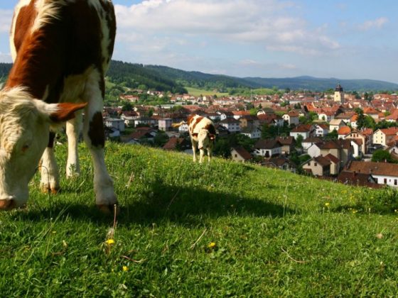


From Pontarlier starts the final climb to cross the Jura mountain. Over a few kilometers, the Via Francigena follows the same direction as the Route of Absinthe linking the comtoise city with Val de Travers, two high places of this drink renowned for its disturbing reputation.
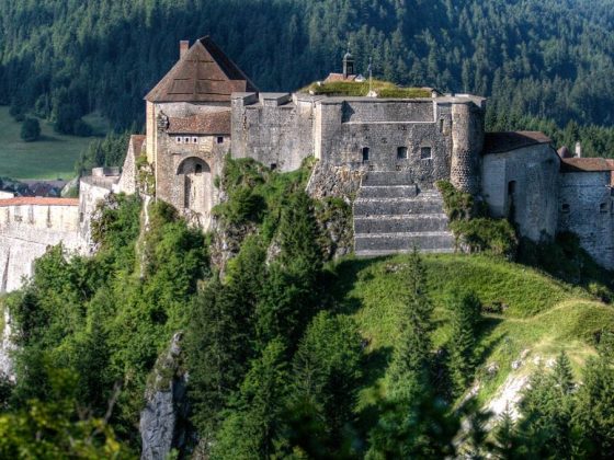
The cluse of Joux is a must on the road to Switzerland. The castle of Joux and the Larmont fort guard this strategic site. Between woods and pastures, the path continues to gain altitude through the wild landscapes of Haut-Doubs to the village of Les Fourgs, before crossing the border at Grand’Borne and reaching Sainte Croix through L’Auberson, capital city of the music box.
INFO: this itinerary follows the variant leg from Pontarlier to St-Croix of the Swiss route.