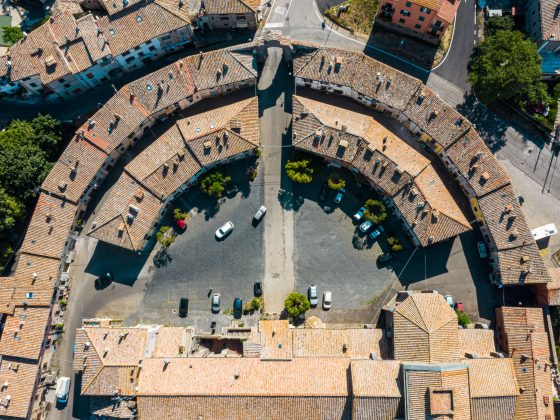
Leg 41 - From Viterbo to Vetralla
Leg 41 - From Viterbo to Vetralla
Gps Track
- Start: Viterbo, Piazza del Plebiscito
- Arrival: Vetralla, Duomo
- Total Length: 21,9 km
- Difficulty by Foot: Medium
- How to arrive:
Linee FS Roma-Viterbo e Orte-Viterbo, stazione Viterbo
The stage 41 Viterbo/Vetralla can be walked (17 km) along the ancient Signorino variant route, track B21 AEVF app
Starting from Piazza del Sacrario, one crosses Piazza del Plebiscito until exiting the medieval walls of Viterbo through Porta Romana; one passes under Porta San Biele and then Via della Grotticella before climbing up Strada Roncone. From here begins a path through chestnut and oak woods until reaching the village of San Martino al Cimino, a hamlet of Viterbo. You enter San Martino al Cimino through the North Gate, skirting the famous 13th-century Cistercian Abbey; after crossing the entire village, you exit through the South Gate. After a few kilometres on easy undergrowth paths and a few stretches on asphalt roads with panoramic views north towards Montefiascone, we enter the woods of Monte Fogliano along shady paths that descend towards the village of Tre Croci, a hamlet of Vetralla. From Tre Croci, there is a short stretch of dirt road that reaches Vetralla, crossing Foro Cassio. It is also possible to reach Vetralla by following the B21 cycle route from Viterbo to Sutri.
- Variant “lungo Taro” 19 – from Collecchio to Fornovo di Taro
- Variant ‘lungo Taro’ 19 – from Parma to Collecchio
- Leg 19bis – From Collecchio to Fornovo
- Leg 21 – Variation Monte Valoria
- Leg 36 – Variation Abbadia San Salvatore
- Leg 27 – From Camaiore to Lucca
- Leg 26 – From Massa to Camaiore
- Leg 25 – From Sarzana to Massa, via Avenza
- Leg 24 – From Aulla to Sarzana
- Leg 37 – Alternative path – Proceno
- Leg 03 – From Aosta to Châtillon
- Leg 23 – From Pontremoli to Aulla
- Leg 43 – Variation 1 – In exit from Sutri
- Leg 32 – Alternative route to Quartaia
- Leg 19 – Short variant for Felegara
- Leg 16 – Alternative route 1 – From Orio Litta to Piacenza along the Po banks
- Leg 06 – Alternative route 1 – Carema
- Leg 04 – Alternative route 1 – Châtillon
- Leg 05 – From Verrès to Pont-Saint-Martin
- Leg 04 – From Châtillon to Verrès
- Leg 02 – From Echevennoz to Aosta
- Leg 01 – From Gran San Bernardo to Echevennoz
- Leg 45 – From La Storta to Roma
- Leg 44 – From Campagnano to La Storta
- Leg 43 – From Sutri to Campagnano
- Leg 42 – From Vetralla to Sutri
- Leg 40 – From Montefiascone to Viterbo
- Leg 39 – From Bolsena to Montefiascone
- Leg 38 – From Acquapendente to Bolsena
- Leg 37 – From Radicofani to Acquapendente
- Leg 36 – From San Quirico to Radicofani
- Leg 35 – From Ponte d’Arbia to San Quirico
- Leg 34 – From Siena to Ponte d’Arbia
- Leg 33 – From Monteriggioni to Siena
- Leg 32 – From San Gimignano to Monteriggioni
- Leg 31 – From Gambassi Terme to San Gimignano
- Leg 30 – From S. Miniato to Gambassi Terme
- Leg 29 – From Altopascio to S. Miniato
- Leg 28 – From Lucca to Altopascio
- Leg 22 – From Passo della Cisa to Pontremoli
- Leg 21 – From Cassio to Passo della Cisa
- Leg 20 – From Fornovo to Cassio
- Leg 19 – From Fidenza to Fornovo
- Leg 18 – From Fiorenzuola to Fidenza
- Leg 17 – From Piacenza to Fiorenzuola
- Leg 16 – From Orio Litta to Piacenza
- Leg 15 – From Santa Cristina to Orio Litta
- Leg 14 – From Pavia to Santa Cristina
- Leg 13 – From Garlasco to Pavia
- Leg 12 – From Mortara to Garlasco
- Leg 11 – From Robbio to Mortara
- Leg 10 – From Vercelli to Robbio
- Leg 09 – From Santhià to Vercelli
- Leg 08 – From Viverone to Santhià
- Leg 06 – From Pont-Saint-Martin to Ivrea
- Leg 07 – From Ivrea to Viverone
- Leg 29 – Variant Ponte Buggianese
- Leg 05 – Variant through Issogne


