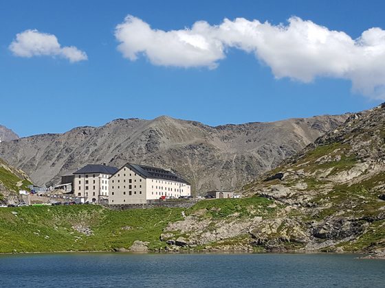
Probably the most symbolic stage but also the most difficult and dangerous!
From the town of Martigny, you can follow the international route. However, the stretch to Bourg-Saint-Bernard (tunnel entrance) is dangerous with many trucks, even if we suggest you some alternatives. The stage lasts 3:30 hours for 47 km and 2155 meters of positive height difference!
If you want to avoid trucks, it is advisable to take the train to Orsières, then the bus to Bourg-Saint-Bernard. You can consult the timetables on www.cff.ch. From there, the stage lasts about 1 hour for 6 km and 560 metres of ascent.
From Martigny, follow the main road to Sembrancher, Orsières, Liddes and Bourg-Saint-Pierre. Where possible or indicated, leave the main road and follow the secondary road through the villages.
From Bourg-Saint-Bernard, leave the road that continues through the tunnel. From there, you will start the last climb, beautiful and wild but difficult!
You will find food and drink in all the villages, and fountains are very common. Drinking water is also available on the last climb.

