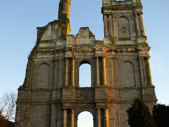


Passing through Mont-Saint-Eloi, you will see the majestic ruined towers of an old abbey for canons, classified as historical monument en 1921 and that can be easily seen from 20km around on a clear day.
You will cross again, for the third time, the Chaussée Brunehaut. Walking downwards, you will meet the marshlands of the river Scarpe in Marœuil, with St. Bertille spring and its chapel. The old flourmill nearby bears the same name. At the end of your daily trip, you will reach Arras, capital city of Pas-de-Calais.